
Do you want to BE a Roman Gladiator? Legionary? Centurion? General?
Senator? We've been living your dream for years!
Be the Hero!
Live the Dream.
![]()
![]()
![]()
![]()
![]()
![]()
![]()
![]()
![]()
SITE
INDEX
This site is best viewed at 1024x768
Look
for us on the
Malice
Trilogy, a Phil Cook Eagle Films Production on Amazon Prime video.

|
ALL ROADS LEAD TO ROME! For your convenience, try: MapQuest
|
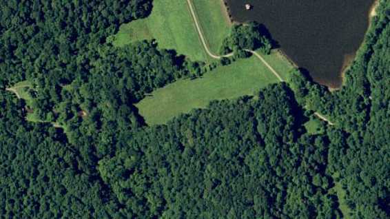
LAKE NEEDWOOD
Derwood, MD
Needwood Lake Circle, Derwood, MD 20855
Take your best route to I-270, N/W of I-495.
At exit 9, take Right Ramp onto I-370, towards Metro Station/Gaithersburg Town Center. Go 2.3 miles.
Pass under bridge and take Right Ramp onto Shady Grove Rd heading East.
Go about 1/4 mile.
Turn Right onto Briardale Rd. Go about 1/2 mile.
Turn Right onto Redland Rd. Go about 1/2 mile.
Turn Left onto Needwood Rd. Go about 2 miles.
Turn Right onto Beach Dr. Go about 1 mile.
Turn Right onto Needwood Lake Circle. Pass the small parking lot and continue until you see people dressed funny! ;-)
LANE MANOR PARK
Hyattsville, MD
2600 University Blvd E,
Hyattsville, MD 20783Take your best route to the North side of the 495/Capital Beltway
Take Exit# 29B, onto MD-193 [University Blvd E] towards Langley Park and
Go 3.5 miles.
Turn Right into the park entrance.
LAKE BERNARD FRANK
ROCKVILLE, MD
Take your best route to the western side of the Washington Beltway, 495.
Take 270 North towards Frederick.
Exit on Rt. 28 East, going towards Rockville.
Passing through downtown Rockville, turn left (North) on First Street (which becomes Norbeck Road).
Turn left on Avery, Lake Bernard Frank parking lot is one mile down on the right.There is limited parking available, try to carpool if you can. Please beware of parking on the roadside - it has led to tickets.
Go back to the top of the page.
MILLERSVILLE ELEMENTARY SCHOOL, MILLERSVILLE, MD.
FROM BALTIMORE
Take I-695 around to I-97 south.
Take I-97 South until you see Rt# 3/301 Crofton (bear to the right.).
Go to the first light, stay in the left lane.
Left on Millersville Road, Go about 2 miles and the school is on the right.FROM ANNAPOLIS
Take Rt# 50 to Rt# 178 North (Generals Hwy.).
Stay on Rt# 178 North (Generals Hwy.), past the Crownsville Hospital (do not go to I-97) to Millersville Road (flashing yellow light.).
Left onto Millersville Road and bear right at the fork.
Millersville Elementary School is about mile on the left.FROM DC AND VIRGINIA
Take I-495/I-95 to the east of D.C. to Rt# 50 East.
Take Rt# 50 east to Rt# 3 north.
Take Rt# 3 north to Millersville Road.
At the light, go right onto Millersville Road.
Go about 2 miles and the school is on the right.
Go back to the top of the page.
FROM BALTIMORE
From Baltimore: South on I-95 towards Washington, DC.
After Columbia Exit, start looking for Exit 35B.
Take Scaggsville, MD Exit 35B, Route 216 West.
Turn Right on Leashure .
Turn left on Glen Hannah
Follow Glen Hannah to the end;
Hammond Park’s entrance will be on the right.FROM DC AND VIRGINIA
North on I-95 towards Baltimore.
After Burtonsville, start looking for Exit 35B
Take Scaggsville, MD Exit 35B, Route 216 West.
Turn Right on Leashure .
Turn left on Glen Hannah
Follow Glen Hannah to the end;
Hammond Park’s entrance will be on the right.
Go back to the top of the page.
REDLAND MIDDLE SCHOOL, ROCKVILLE, MD
FROM BALTIMORE
Take I-695 to I-70 West towards Frederick.
Take I-70 West to Rt# 29 South towards Columbia.
Take Rt# 29 South to Rt# 32 West or take I-695 to I-95 South to Rt# 32 West.
Go to Rt# 108, turn left at stop sign.
Take Rt# 108, past Rt# 650, past Rt# 97 (Georgia Ave), to Muncaster Road.
Left at the light onto Muncaster Road.
Go to the next light (Muncaster Mill Road).
Left at the light onto Muncaster Mill Road.
School is a mile or so down on the left.FROM ANNAPOLIS
Take Rt# 50 West to I-495 West.
Go to Rt# 97 North (Georgia Ave.), Exit #31.
Go to Norbeck Road (Rt# 28).
Left at the light onto Norbeck Road (Rt# 28).
Take Norbeck Road (Rt# 28) to Muncaster Mill Road.
Right onto Muncaster Mill Road.
The school is a couple miles down on the right.FROM DC AND VIRGINIA
Take I-495 North to Rt# 97 North (Georgia Ave.), Exit# 31.
Go to Norbeck Road (Rt# 28).
Left at the light onto Norbeck Road (Rt# 28).
Take Norbeck Road. (Rt# 28) to Muncaster Mill Road.
Right onto Muncaster Mill Road.
The school is a couple miles down on the right.

Go back to the top of the page.
FROM BALTIMORE
Take I-695 to I-95 South
Take I-95 South to I-495 West.
Take I-495 towards Rockville into Virginia to Route 50 East (Arlington Blvd)
Turn right on to Annandale Road (Route 649).
Roundtree Park is a mile or two down on the left.FROM ANNAPOLIS
Take Rt# 50 West to I-495.
Take I-495 West towards Rockville into Virginia to Route 50 East (Arlington Blvd)
Turn right on to Annandale Road (Route 649).
Roundtree Park is a mile or two down on the left.FROM DC AND VIRGINIA
Take I-495 to to Route 50 East (Arlington Blvd)
Turn right on to Annandale Road (Route 649).
Roundtree Park is a mile or two down on the left.
Go back to the top of the page.
GREENBELT PARK, GREENBELT, MD
From the North side of the Washington Beltway, take exit 23 Kenilworth Avenue south
Veer right on first exit to Greenbelt Road
Take a left on to Greenbelt Road eastbound
Greenbelt Park should be on right side 1/4 mile down
Go back to the top of the page.
RAGNAROK!
OLD Directions - please refer to Coopers Lake in Pennsylvania!
LINGANORE WINERY, MT. AIRY, MD
FROM ANNAPOLISFROM BALTIMORE
Take I-695 to I-70 West towards Frederick.
Take I-70 West, past Rt# 32, past Rt# 97, past Rt# 27, to Rt# 75 North, Exit 62.
Right onto Rt# 75 North, continue to Glissans Mill Road.
Go past the flashing lights, turn right onto Glissans mill Road.
Linganore Winery is a few miles down on the right.
Turn right into the winery.
Once on the property keep your speed below 10 mph.
Take the first left, past the barn to top of the hill.
Take left down to the woods and park.
Take Rt# 50 East to I-495 West.
Take I-495 to I-270 North.
Take I-270 North to I-70 East at Frederick using the Market Street Exit.
Take left exit to I-70 East towards Baltimore to Rt# 75 North.
Take Rt# 75 North to Glissans Mill Road.
Go past the flashing lights, turn right onto Glissans Mill Road.
Linganore Winery is a few miles down on the right
Turn right into the Winery.
Once on the property keep your speed below 10 mph.
Take the first left, past the barn to top of the hill.
Take left down to the woods and park.
(Or take I-95 North to I-70 West, and follow the Baltimore directions.) FROM DC AND VIRGINIA
Take I-495 North to I-270 North
Take I-270 North to I-70 East at Frederick.
Take I-270 North to I-70 East at Frederick using the Market Street Exit.
Take left exit to I-70 East towards Baltimore to Rt# 75 North.
Take Rt# 75 North to Glissans Mill Road.
Go past the flashing lights, turn right onto Glissans Mill Road.
Linganore Winery is a few miles down on the right
Turn right into the Winery.
Once on the property keep your speed below 10 mph.
Take the first left, past the barn to top of the hill.
Take left down to the woods and park.
Go back to the top of the page.
LITTLE
BENNETT PARK
CLARKSBURG, MD
(NORTH OF GERMANTOWN)
From the South, East, or West of the Washington DC Metro area:
Take your best route to the Washington Beltway (495). Travel around the Beltway until you get to I-270. Go North on I-270.
From the North: Take you best route to I-70, and travel to I-270. Go South.
All, from I-270:
Exit onto MD Route 121 towards Clarksburg. Travel East on Clarksburg
Road.
You will cross over 355... DO NOT TURN, even if you see a sign... that is for the Camper area, not the
primitive sight where we are.
Continue East on MD 121... you will cross over a small bridge.
Once you have crossed it, look to your right. You will see a gravel road with a Park Kiosk and a gate, which SHOULD be opened if you arrive
after 6pm (if you are early, you may end up waiting for me).
Turn right onto the gravel road. You will travel on this twisty-turny road until you can no longer follow it, because there is a gate.
Park and gear up.
MARIETTA
MANSION
GLEN DALE, MD
Marietta Mansion is at 5626 Bell Station Rd., Glenn Dale, MD 20769. 301-464-5291.
From I-95/495, the Capital Beltway, take Exit 20 onto Rt. 450 East
Go 4 miles
Turn left on Rt. 193
Turn left onto Bell Station Rd.
Turn left again into Marietta.
Directions from the Baltimore:
Get on 95 south. Drive a while.
When you get to the Washington beltway, the highway splits.
Take the left fork: 95/495 south.
Take exit 23: Kenilworth Ave.
Stay in the right lane so you can turn left onto Rt. 193 on the over-pass (you'll see what we mean when you get there).
Follow that road till you see signs for Marietta Mansion on the right.
If you come to the Rt. 450 junction, you just missed it so turn around and take your first left.
Directions from Virginia:
Get on 95 north to 95/495 north.
Take exit 23 and follow the directions from Kenilworth Avenue above.
LAYHILL
PARK
ROCKVILLE, MD
FROM BALTIMORE
Take I-695 to I-95 South toward Washington.
Take 495 West towards Silver Spring.
Take 495 West to Rt# 97 North (Georgia Ave.).
Take 97 North (Georgia Ave.) to Layhill Road.
Right at the light onto Layhill Road.
Layhill Park is several miles down on the right.FROM ANNAPOLIS
Take Rt# 50 West to I-95/I-495.
Take I-495 West to Rt# 97 North (Georgia Ave.).
Take 97 North (Georgia Ave.) to Layhill Road.
Right at the light onto Layhill Road.
Layhill Park is several miles down on the right.FROM DC AND VIRGINIA
Take I-495 North to Rt# 97 north (Georgia Ave.).
Take Rt# 97 North to Layhill Road.
Right at the light onto Layhill Road.
Layhill Park is several miles down on the right.
Mark Twain Elementary
Rockville, MDTake your best route to the western side of the Washington Beltway, 495.
Take 270 North towards Frederick.
Exit on Rt. 28 East, going towards Rockville.
Passing through downtown Rockville, turn left (North) on First Street (which becomes Norbeck Road).
Turn left on Avery, Mark Twain Elementary is half a mile down on the right.
- Take I-495 W towards Northern Virginia to Exit 9 (I-66 W)
- Take I-66 West to Exit 62, Nutley Street North.
- Turn left onto Courthouse Rd.
- Make a left into Nottaway Park (less than 1/2 mile.)
- Follow the park road around to the right and park below the athletic fields.
Go back to the top of the page.
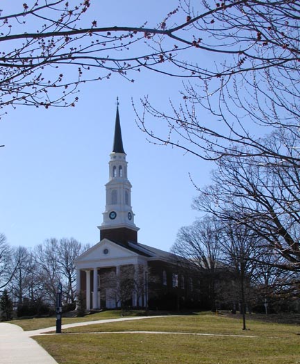
University of
Maryland,
College Park Campus
Take your best route to the Northern Capital Beltway, I-495
Take the exit for Rt. 1 (in Maryland) south.
Follow for about a couple of miles until the University can be seen on your right.
After the first entrance and a few buildings you can see the very large field in front of the chapel.
Turn right into the second entrance on Campus and begin looking for parking.
Take special care to read all parking lot notices carefully. Many lots allow parking on the weekend, some do not.
Practice begins at noon on all non-event Saturdays.
WHITE MARSH PARK
Bowie, MDFrom DC/VA:
Take Rt. 50 East towards Annapolis off of the DC Beltway 495.
Drive about 5 miles and take the exit for Rt. 3 North towards Crofton.
This will be Exit 13 (B?). Merge onto Rt. 3 and get left asap.
Make a U-Turn at the first light (Rt. 450) and go back down Route 3 heading South.
The park is just ahead on the right. (White Marsh Park Dr)
From Baltimore:
Take 97 South or 32 South to Rt. 3/301 South towards Bowie.
Drive past the Coyote Cafe/ Millersville area and pass several lights.
When you pass Route 450 on your right the park will be just ahead on the right side. (White Marsh Park Dr)
From Annapolis:
Take Rt. 50 west towards Washington
Take Exit 13B (?) for Rt. 3 North towards Crofton.
Make a U-Turn at the first light (Rt. 450) and go back down Route 3 heading South.
The park is just ahead on the right. (White Marsh Park Dr)
From Washinton
- Take I-95 North, stay on thru Baltimore, wake up when you hit the Susquehanna River bridge. (This is north of Baltimore.)
- Take the first exit (Exit 93) after the toll booth (MD 222), towards Port Deposit. (The exit is really right after the toll booth; perhaps 300 meters.)
- Turn in the direction of Port Deposit.
- Go through 2 red lights and at the flashing red light, make a right on Rt 276.
- Go about 1.7 miles. The farm is on the left hand side, about a mile and a half down. No one is allowed on site before 5 PM.
- However, it is a turn between trees, so you have to be looking HARD for it. (If you actually end up in Port Deposit, you have gone too far.)
- Take I-95 North towards Philladelphia and New York, wake up when you hit the Susquehanna River bridge. (This is north of Baltimore.)
- Take the first exit (Exit 93) after the toll booth (MD 222), towards Port Deposit. (The exit is really right after the toll booth; perhaps 300 meters.)
- Turn in the direction of Port Deposit.
- Go through 2 red lights and at the flashing red light, make a right on Rt 276.
- Go about 1.7 miles. The farm is on the left hand side, about a mile and a half down. No one is allowed on site before 5 PM.
- However, it is a turn between trees, so you have to be looking HARD for it. (If you actually end up in Port Deposit, you have gone too far.)
Go back to the top of the page.
Patuxtent River Park
16000
Croom Airport Rd, Upper Marlboro, MD 20772-8395
From the DC Beltway in Maryland take exit 11 for MD-4 South/Pennsylvania Avenue East toward Upper Marlboro.
Go 7.7 miles and turn onto US-301 South.
In 1.8 miles turn left at Croom Station Road.
At the ‘T’ intersection in 1.6 miles turn left onto Croom Rd/MD-382S.
In 1.5 miles turn left at Croom Airport Road and go 2.9 miles.
Turn right toward barn and park.
ROSERYVILLE
STATE PARK,
UPPER MARLBORO, MD
Take your best route to the Washington Beltway, I-95, I-495.
Exit on Hwy. 4/Pennsylvania Ave towards Upper Marlboro. This exit is about the 4 o'clock position of the beltway circle.
Follow Hwy. 4 about 7.5 miles to Hwy. 301 South. Follow 301 south for about 4 miles.
The site, Roseryville State Park, is on the right just after Osborne Road.
Follow the SCA signs to the picnic shelter area.
CAMP RAMBLEWOOD
2564 Silver Road
Darlington, MD 21034From Washington D.C. and Points South
- Take Beltway (I-495) into Maryland to I-95 North.
- Take I-95 North through Baltimore Harbor Tunnel. Remain on I-95 North toward New York (J.F.Kennedy Highway).
- Proceed on I-95 North to the Havre de Grace exit.
- Turn Left towards Churchville and Bel Air, Proceed on Route 155 for three miles. Turn Right onto Route 161 and proceed five miles into Darlington.
- Turn Right onto Shuresville Road. Proceed about one and a half miles on Shuresville Road and watch for Silver Road on your right. Enter Silver Road and proceed a half-mile into Ramblewood.
Take your best route to I-270From South of Exit #10
Take Exit#10, MD-117 Clopper Rd. North/West
Go about 1/2 mile and cross Quince Orchard Rd
Continue on Clopper Rd without turning.
From North of Exit #11
Take Exit#11, MD-124 Quince Orchard Rd, South/West
Continue on Quince Orchard Rd for about 1/2 mile.
Turn Right onto MD-117 Clopper Rd.
From the intersection of Clopper Rd and Quince Orchard Rd
Continue North/West on Clopper Rd for 2 miles
Turn Right onto Warring Station Rd and go about 1/4 mile
Turn Right into the entrance.
* The entrance is hidden in the trees, so look carefully!
Go back to the top of the page.
WHEATON-CLARIDGE PARK
11901 Claridge Road
Wheaton, MD 20902Take your best route to the North side of the Washington Beltway, 495.
Take exit #31, MD 97 (Georgia Avenue) North.
Continue North on Georgia Avenue for about 2 miles.
Veer left onto Viers Mill Road and drive about 1.5 miles.
Turn right on Claridge Road and drive about .1 mile.
Turn right into park entrance
Old Adelphi Mill,
Adelphi, MD
Take your best route to the Northeast side of the Washington Beltway, 495
Take exit 25B, Route 1 South, College Park
Turn Right on University Blvd (going toward Byrd Stadium). Go past Aldelphi Road and Shoppers Food Warehouse.
Right on Riggs Road
Go about 1 mile and Adelphi Mill will be on the left.
Fountainhead Regional Park
Fairfax Station, VA
April 5, 2003 Aedile's EventTake I-95 south of the Beltway.
Exit at Occoquan and travel north on Rt. 123 approximately 5 miles.
Turn left onto Hampton Road and drive 3 miles to the entrance on the left. http://www.nvrpa.org/directory.html Diamond number 4.
BLUE RIDGE FARM:
MARKLAND BATTLE DIRECTIONS
Directions (from Baltimore);
Take the Baltimore beltway (695) to 83 north.
Get off at the Mt.Carmel Rd. exit, and take a left at the end of the ramp onto Mt. Carmel Rd.
Follow Mt. Carmel until you come to a flashing red light. This is Falls Rd.
Make a right and head north onto Falls Rd. You will soon come to Gunpowder Rd. There is a sign for the road before you get there and it is in a short valley just before the road goes up the next hill.
Make a left onto Gunpowder Rd. The field after the first hedgerow/stream/bramble on the left is ours and where we plan to have most of the event. You should see some cars parked around the edge of this field unless you get there real early. The filed has fence posts around it but the side boards haven't been put up yet.
The house is on Falls road at the crest of the next rise on the left. It will be the second driveway on the left after you pass Gunpowder.
If your on 83 and enter PA, you are too far north turn around. If your on Mt. Carmel and you come to a stop sign at a tee in the road. You've gone too far. Turn right and you're on Gunpowder. You'll go over a small bridge and you'll be here. If your on Falls Rd. and you see a church, you've gone too far, turn around, Gunpowder rd. will be the first street you come back to, just make a right when you get there this time.
Go back to the top of the page.
From the 495 Washington Beltway in Virginia, directions are as follows:
Take Route 50 (Arlington Blvd.) East from 495.
At 7 Corners, Take Route 7 East Towards Alexandria.
At the fourth light, turn Right on Nevius.
Take your first right on Wilkins Drive.
The Villa Dominus is at 3327 Wilkins Drive, and it will be on the left.Call First: 571-235-6432
From DC and all points south:
Follow 395 to Route 7 (King Street).
Take King Street west from 395.
Go through Bailey's Crossroads. From the Culmore Shopping Center (on your left), take a left at the second light, Nevius Drive.
Take your first right on Wilkins Drive.
The Villa Dominus is at 3327 Wilkins Drive, and it will be on the left.Call First: 571-235-6432
MAP:
DIRECTIONS TO GURRUNDI'S
VAST COUNTRY ESTATETake your best route to I-95, between DC & Baltimore
Take I-95 to MD-32 W
Take MD-32 W to US-29 S
Take US-29 S to Johns Hopkins Road (take the ramp to the right) (Ensure that once you've merged onto Johns Hopkins Road, you move over to the leftmost lane.)
Turn LEFT onto OAKCREST LN. (0.1 miles)
Turn RIGHT onto CHERRY TREE DR. (0.2 miles)
Turn RIGHT onto TERI LYNN DR. (<0.1 miles)
End at 11716 Teri Lynn Dr Fulton MD
Park in front of the house. Do not park in the driveway.
Go around the back of the house until you see the lower garage. We will be there.
Galacia's Markland Arena Practice
7:00 - 10:00 Sunday nights
From the Baltimore Beltway, 695, take 70 west towards Frederick
Take the MD-94 exit, exit number 73, towards Woodbine/Lisbon.
Keep right and merge onto the road
(In front of you is a traffic circle) Make a left at the circle
Follow the road until you reach a stop sign.
Make a right at the stop sign
Go down the road a little ways and the farm is on your left, it is on a bend in the road and is easy to miss. However right before you get there you should be able to see the indoor arena illuminated on your left
from a distance.
Please drive all the way back and park near the other cars, not on the grass. I will see about having a flag of some kind out front for people. Arena runs 7-10 and sometimes later.
Directions to Sugarloaf Mountain,
Comus, MDMake best route to I-495
Take 270 west towards Rockville/Frederick
About 20 miles later, take the MD-109 exit towards HYATTSTOWN
(There will be a brown sign directing you to Sugarloaf Mountain from I-270)
Keep RIGHT at the fork in the ramp.
About 5 miles later, turn Right onto Comus Rd, (MD - 95) .
There will be another brown sign directing you to Sugarloaf Mtn here).
When you reach the Sugarloaf Mtn gate, drive slowly up the mountain, observing all the directional signs (one way only). This route will take you directly to the Potomac Overlook, east and west views.
PILGRIM HILLS RECREATIONAL CENTER
1615 E. Randolph Road
Colesville, MDTake exit for Route 29 North (Colesville Road) off I-495 (Capital Beltway)
Follow Route 29 past New Hampshire Avenue / White Oak area
Make left on Randolph Road - recreation center approx. 1 mile on left